blah blah blah
The Flume
Length: 2.4 mile loopDifficulty (click for info): Easy
Elevation Gain: 660 feet
Rating (click for info): 9/10
Height: 45' (Avalanche), 70' (Liberty), and 30' (Pool)
Source: Flume Brook (Avalanche), Cascade Brook (Liberty), and Pemigewasset River (Pool)
Driving Directions:
Trailhead and parking area are on Rt. 3 in Lincoln, NH. The entrance to the large parking complex is just a short distance north of the off-ramp to exit 34A on I-93, on the east side of the road. There are two entrances. If visiting during the off-season, you will want to enter at the second (northern) entrance and drive toward the end of the lot near the visitor center. Click here for a Google map.
About the Hike:
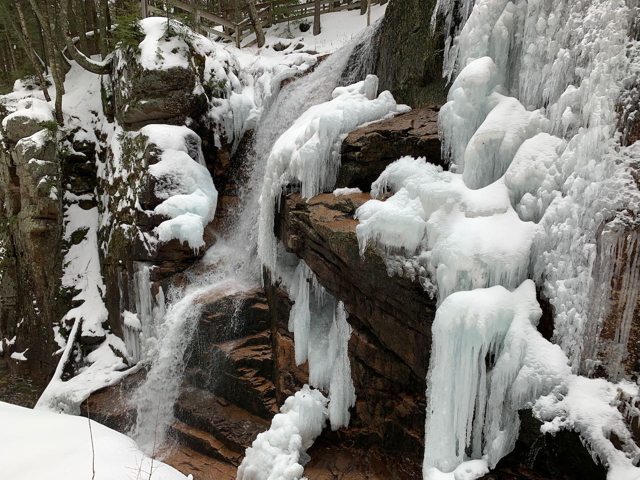
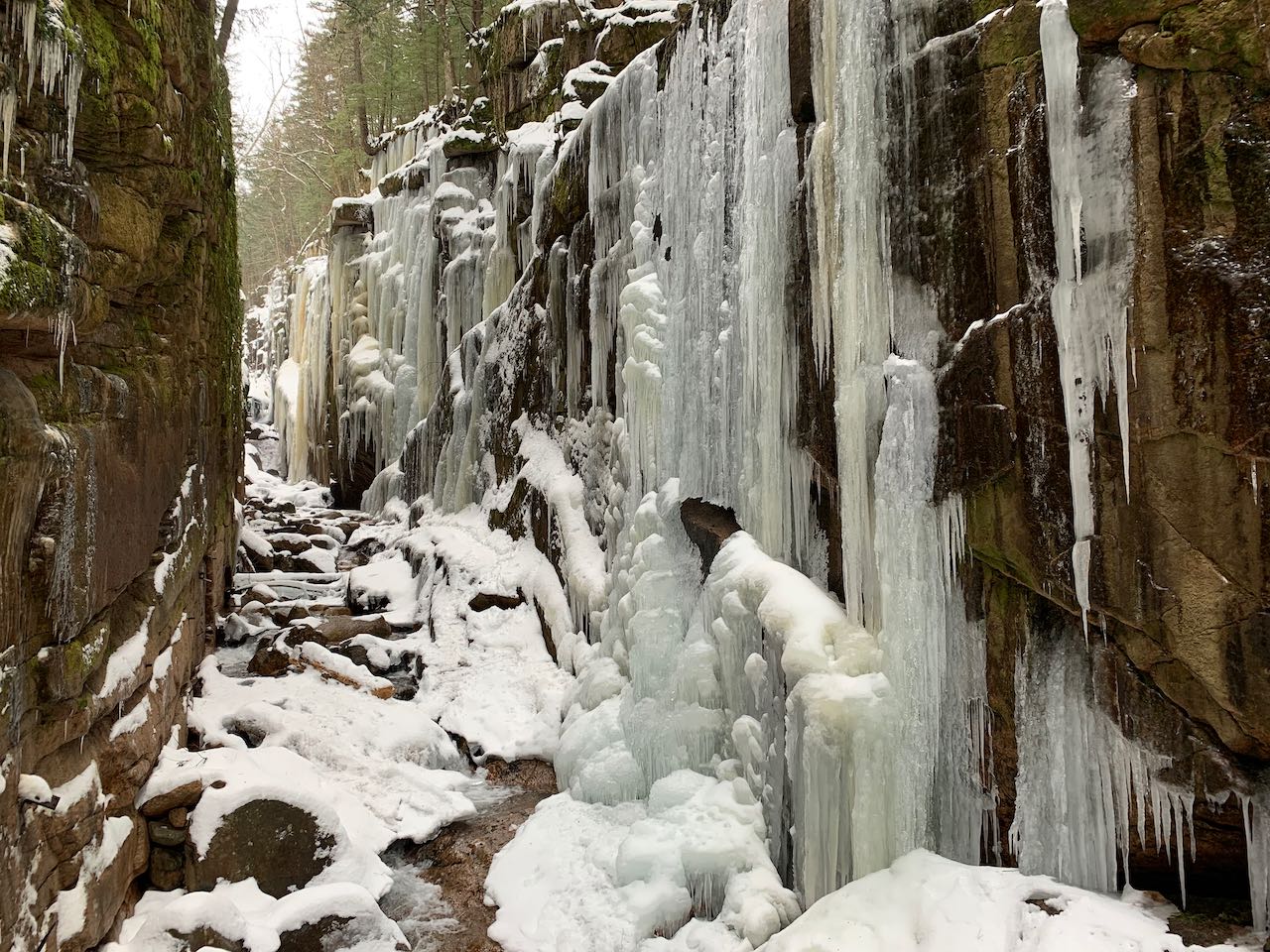
The Flume Gorge is one of the White Mountains' premiere tourist attractions. Each summer possibly millions of people experience the thrill of traversing the boardwalk between the vertiginous rock walls of the gorge. The park encompasses three notable waterfalls, each being among New Hampshire's most scenic. The Flume is famous for good reason, and its incredible natural beauty has cemented its iconic place in the minds of many. An entrance fee is collected at the visitor center during the in-season (see the State Parks page for details), but access is allowed when the park is not operating. This makes the winter season potentially the best time to visit the Flume. Those who visit in the cold season will gain a host of different scenic experiences, foremost being the awe-inspiring ice masses that form on the walls of the gorge. Depending on the weather conditions, some of the waterfalls may freeze over as well. One important note is that despite being graded tourist paths, the steeper parts of trail through the Flume can become slippery with snowpack, so you may want to be prepared with traction devices.
Since we'll describe the hike from the winter perspective, you'll start your hike right from the parking area. The trail enters the woods in front and to the left of the shuttered visitor center. Look for it in the middle of the curved drive conecting the two northernmost parking lots. The path, only available when the visitor center is closed, crosses a bridge over a tiny stream and bypasses the building. In 0.1 miles, head straight across a bus access road. 350 feet further, the loop begins. Bear right at this fork and follow the path as it makes a long switchback downhill for 0.15 miles to a covered bridge over the Pemigewasset River. You will cross an adjoining bridge for foot traffic. Walk uphill for 0.1 miles, passing the hut at the end of the road from the visitor center. A short distance further, just past the beginning of the official footpath, you'll walk along the edge of a huge opening on Flume Brook called Table Rock, where the water spreads out across a wide open rock slab. The path follows closely beside the edge of the brook for 0.15 miles until it comes to a junction, with a bridge on the left. Continue straight for now. This will put you on the famous boardwalk that clings to the gorge walls.
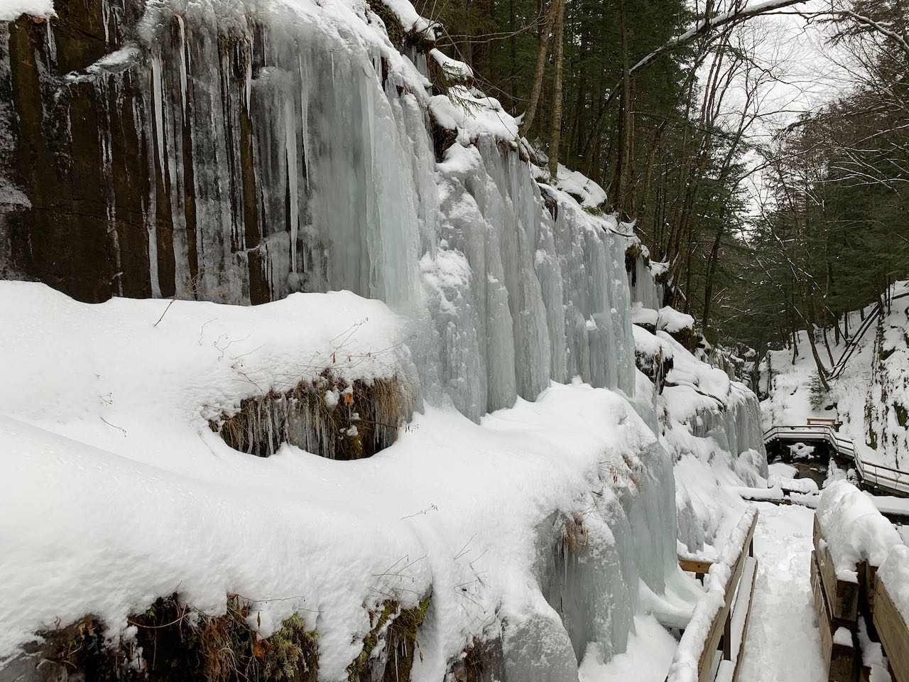
The winter scene is quite one-of-a-kind here. Toward the bottom, snow drapes over the precipitous hillsides, blanketing over the green mosses. The boardwalk switches sides of the gorge, then runs a little further before reaching the point where it is disassembled at the end of each season. From here, you can gaze up through the higher part of the gorge, where ice will dominate, forming countless giant icicles as it migrates from the top of the cliffs to the bottom. Summer visitors would continue up the boardwalk here at it switches sides again and climbs up alongside Avalanche Falls. Turn around here and return to the bridge. Cross the brook and follow path up through the woods, swinging away from the brook and then toward it again. It soon follows along a fence keeping it back from the edge of the gorge. Stay toward the fence, avoiding an abandoned trail cutting off to the left. In a quarter mile, you'll reach a junction where the main loop turns left. Stay straight toward the head of the gorge, now back on the main trail coming from the boardwalk. A path on the right leads down to a viewing area at the top of Avalanche Falls. You can feel up close and personal with the waterfall here as it plunges over the edge of the cliff, as well as peer down into the gorge. You can also get a nice side view of the falls. Head back up and cross the bridge over the brook. Descend the staircase into the top of the gorge (use caution, as the steps may be buried in snow) and follow the boardwalk down to where it will again be blocked off. You can get fairly close to the falls here and observe the whole of the drop - nearly vertical as it careens over blocky ledge. This is also the best place to observe the ice, which will be close up to the boardwalk here.
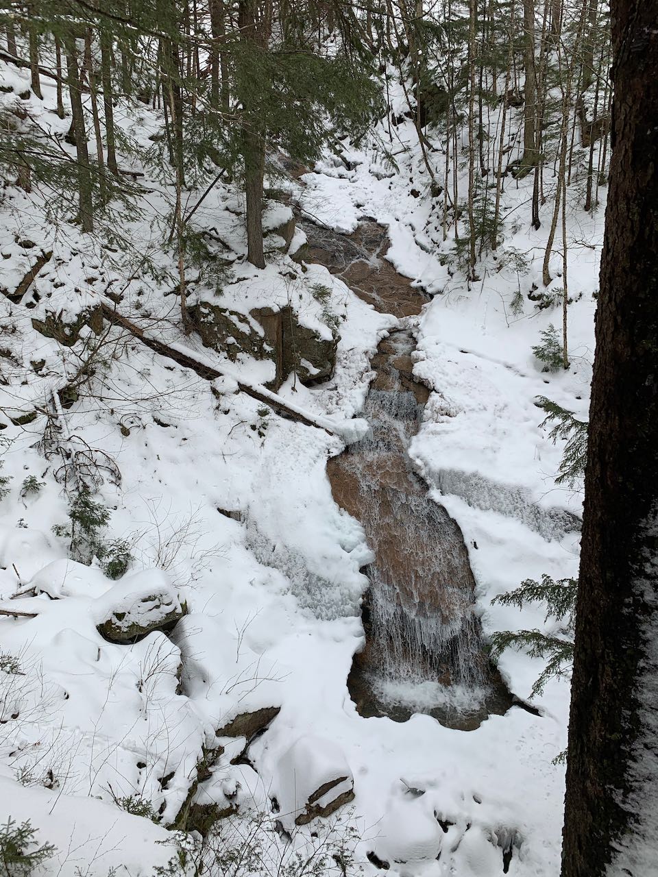
Returning to the top, continue on the main loop. You'll now enjoy a mellow stroll through the woods away from Flume Brook to get to the next attractions. After 0.15 miles walking downhill, look for a short path on the left leading up to a fence with a cleared view out to some of the low hills at the south end of Franconia Notch. You should also be able to see the visitor center through the trees, on the right side. After another 0.35 miles gently downhill through the woods, the path crosses Cascade Brook and passes by a rain shelter. It swings across the hillside for another 250 feet, and then you will see a spur path on the left, which will take you down to a viewing area for Liberty Gorge Cascade. From this platform, you look down on the falls from above, as they fan out gracefully over a steeply angled ledge and spray into a small pool. The surroundings are not anything like Avalanche Falls, but the strength of the waterfall itself is on par.
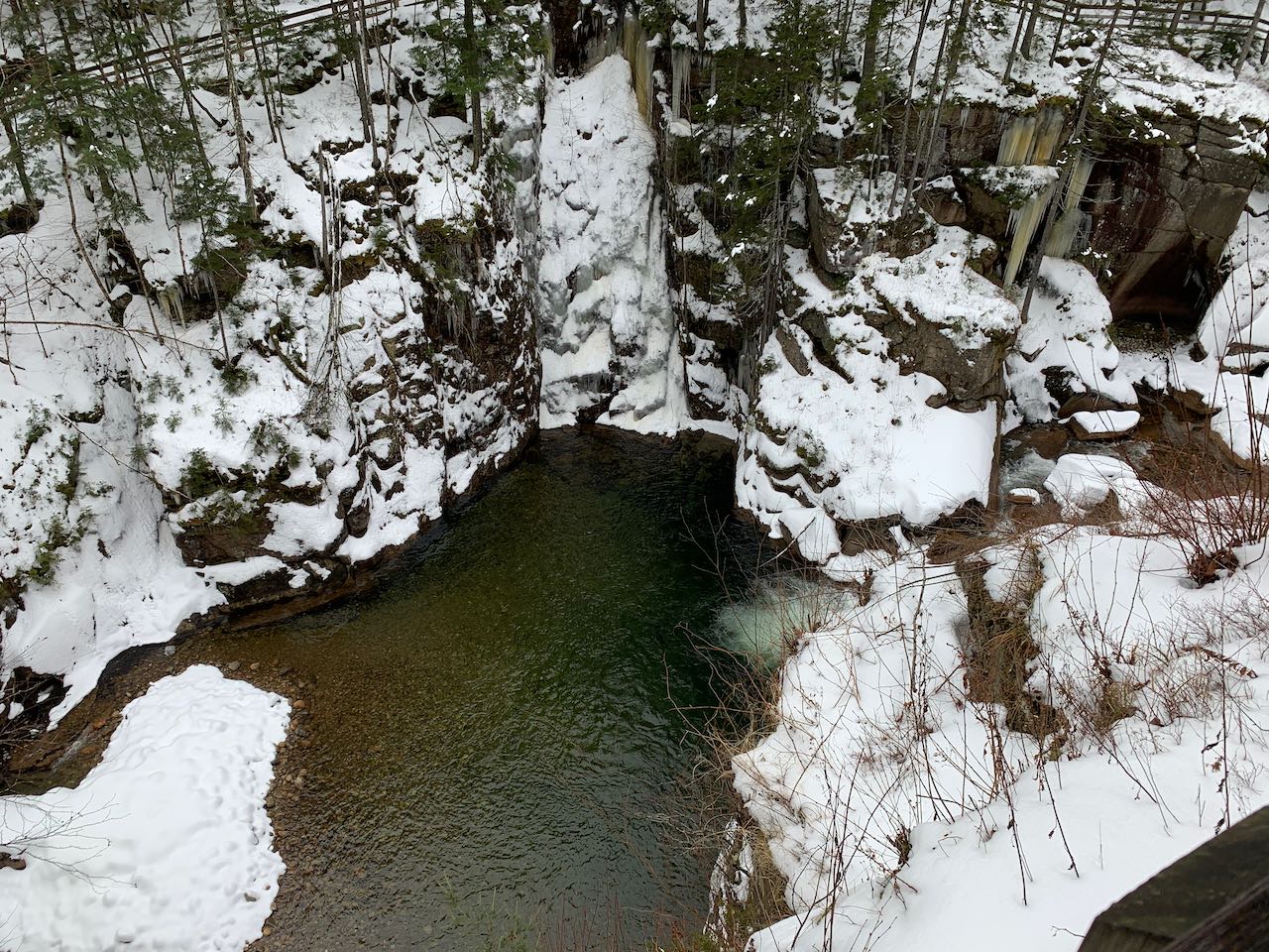
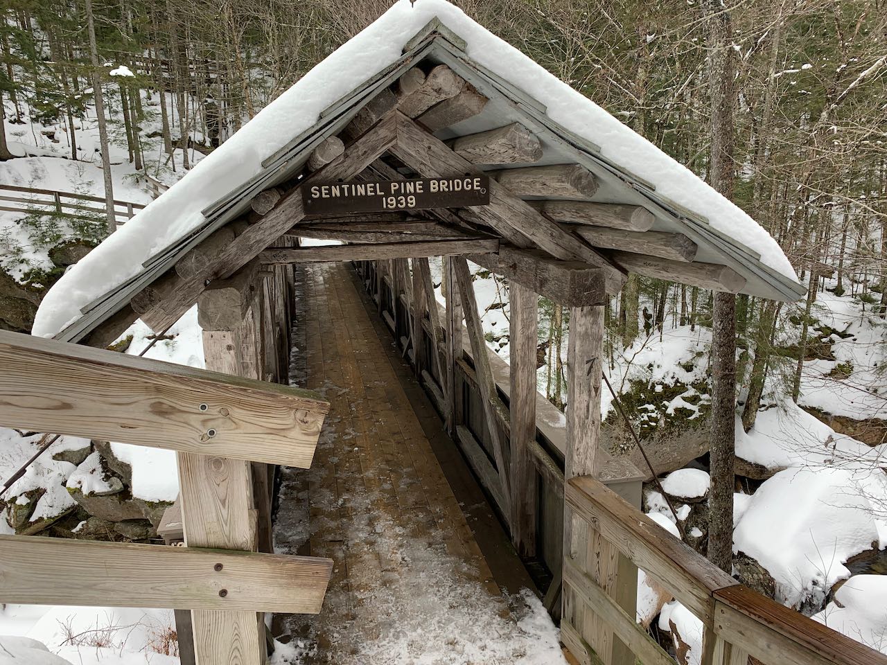
300 feet further down the path, you'll come to the next attraction, the Pool, which is on the Pemigewasset River itself. What gives the Pool its name is an area of deep water, underlaid with smooth stones, that widens out a small area of the river into the alcoves of the cliff walls around it. But what makes the Pool a marvel to view are the said cliff walls, which rise significantly higher than even those in the Flume Gorge. From another viewing area on the left side of the trail, you can gaze over the edge of the walls from the very top. Just beyond this, the trail zigzags down to the river just upstream of the Pool and the cliff walls, where a covered bridge built from a single tree trunk spans the river over a shorter waterfall that cascades over boulders. Cross the bridge and come to a junction where a longer spur path leads to the left atop the cliffs to another viewing area where you can look over the Pool from the opposite side. Around this area on the main trail, you also pass the short loop through a boulder cave called the Wolf Den, which is closed off in winter. Leaving the river behind, the path climbs uphill and then levels off, coming close to the Franconia Notch bike path. After a while, it descends again, passing by several huge boulders. You'll reach the beginning of the loop in another 0.4 miles, where you can return the way you came.
Printable directions page